Grand Canyon: Rim to River and Back Hike
*The Long Way Down*
A lot of people come to stare off into the vastness of the Grand Canyon. Many venture down one of the trails leading deep towards the canyon floor. Most turn back after a mile or two, and some might even make it down to a solid turn around spot like Indian Gardens. Even though I knew I would be here for almost two weeks I knew I wouldn't have much time for really big hikes. So with one of my extreme team campers from Catalina I ignored all the signs warning against hiking from the rim to the river back up the rim in one day, and off we went.

*Bright Angel Trail Head*
The Bright Angel trail is considered the premier hiking trail into the Grand Canyon. It starts on top of the South Rim in Grand Canyon Village, just behind the historic Bright Angel Lodge. Going from rim to river to rim is warned against for very good reasons. The total elevation change is around 9,000ft down and up over the span of 16 miles. You can find water along the way at different rest houses but there is a six mile stretch past Indian Garden down to the Colorado river and back where drinkable water is absent. It did not escape my notice that all the warning signs had a picture of a fit guy in his mid 20's and read, 'this is the kind of hiker we saved over 200 times.'

*Most Dangerous Wildlife*

The temperature and dehydration can be the real dangers of this trail. Even if temperatures are in the upper 80's at the beginning of the trail (6860ft elevation), it can be well into the 100's at the bottom of the canyon (2480ft elevation). We made sure to bring plenty of water and sunscreen, although I did end up regretting the lack of a hat. The other big danger of the trail....animal attacks! Although the most common animal attack is a bite from a squirrel! Don't feed the squirrels.

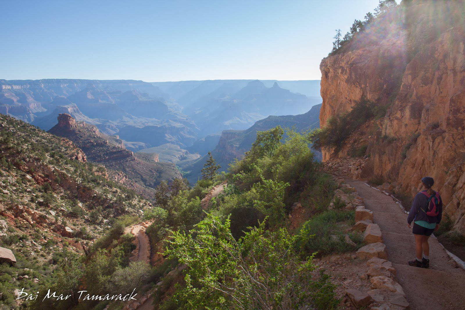
*Still Going Down*
The trail itself is a pretty consistent sloping grade. Going down is deceptively easy but after a few miles even that starts to wear on the muscles. But all you have to do is stop, whip out the camera, and soak in the incredible views. There is almost no way to take in the true scope of the canyon until you descend deep to the bottom of it. I can only imagine what the first adventurers to set eyes on the Grand Canyon must have thought.


*Beginning of the climb up*

*Made it! The Colorado River*
After many water breaks and switchbacks we came to our destination, the might Colorado river. It was red with erosion from previous storms and very cold. There was a sign saying 'no swimming' but I had to go test the waters at least a little bit. It was most refreshing and a much needed revitalization for the long trek up still to come.

*Mule Train*
![image.png](https://files.peakd.com/file/peakd-hive/dtam/23xAMSWQbBjpohjLguGNyp2Pt7cCXk1sEjwaLXExdLuA
[…]